Jammu and Kashmir


| Country | |
|---|---|
| Established | 1947-10-26 |
| Capital | * Jammu (winter)
|
| Largest city | Srinagar |
| Districts | 22 |
| Government | |
| • Governor | Narinder Nath Vohra |
| • Chief Minister | Omar Abdullah (NC) |
| • Legislature | Bicameral (89 + 36 seats) |
| Area | |
| • Total | 222,236 km2 (85,805.8 sq mi) |
| Area rank | 6th |
| Population (2011) | |
| • Total | 12,548,926 |
| • Rank | 18th |
| • Density | 56.5/km2 (146.2/sq mi) |
| Time zone | IST (UTC+05:30) |
| ISO 3166 code | IN-JK |
| HDI | |
| HDI rank | 17th (2005) |
| Literacy | 66.7% (21st) |
| Official languages | Urdu, Kash |

Jammu and Kashmir is the northernmost state of India. It is situated mostly in the Himalayan mountains. Jammu and Kashmir shares a border with the states of Himachal Pradesh and Punjab to the south and internationally with the People's Republic of China to the north and east and the Pakistan-administered territories of Azad Kashmir and Gilgit-Baltistan, to the west and northwest respectively.
Formerly a part of the erstwhile Princely State of Kashmir and Jammu, which governed the larger historic region of Kashmir, this territory is disputed among China, India and Pakistan. Pakistan, which claims the entire territory, refers to it as Indian-occupied Kashmir while some international agencies, such as the United Nations, call it Indian-administered Kashmir.
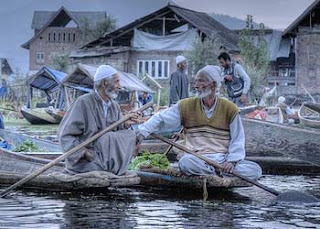
Jammu and Kashmir consists of three regions: Jammu, the Kashmir valley and Ladakh. Srinagar is the summer capital, and Jammu is the winter capital. While the Kashmir valley is famous for its beautiful mountainous landscape, Jammu's numerous shrines attract tens of thousands of Hindu pilgrims every year. Ladakh, also known as "Little Tibet", is renowned for its remote mountain beauty and Buddhist culture.

Jammu and Kashmir is home to several valleys such as the Kashmir Valley, Tawi Valley, Chenab Valley, Poonch Valley, Sindh Valley and Lidder Valley. The main Kashmir valley is 100 km (62 mi) wide and 15,520.3 km2 (5,992.4 sq mi) in area. The Himalayas divide the Kashmir valley from Ladakh while the Pir Panjal range, which encloses the valley from the west and the south, separates it from the Great Plains of northern India. Along the northeastern flank of the Valley runs the main range of the Himalayas. This densely settled and beautiful valley has an average height of 1,850 metres (6,070 ft) above sea-level but the surrounding Pir Panjal range has an average elevation of 5,000 metres (16,000 ft).
Because of Jammu and Kashmir's wide range of elevations, its biogeography is diverse. Northwestern thorn scrub forests and Himalayan subtropical pine forests are found in the low elevations of the far southwest. These give way to a broad band of western Himalayan broadleaf forests running from northwest-southeast across the Kashmir Valley. Rising into the mountains, the broadleaf forests grade into western Himalayan subalpine conifer forests. Above treeline are found northwestern Himalayan alpine shrub and meadows. Much of the northeast of the state is covered by the Karakoram-West Tibetan Plateau alpine steppe. Around the highest elevations, there is no vegetation, simply rock and ice.
The Jhelum River is the only major Himalayan river which flows through the Kashmir valley. The Indus,Tawi, Ravi and Chenab are the major rivers flowing through the state. Jammu and Kashmir is home to several Himalayan glaciers. With an average altitude of 5,753 metres (18,875 ft) above sea-level, the Siachen Glacier is 70 km (43 mi) long making it the longest Himalayan glacier.
The climate of Jammu and Kashmir varies greatly owing to its rugged topography. In the south around Jammu, the climate is typically monsoonal, though the region is sufficiently far west to average 40 to 50 mm (1.6 to 2 inches) of rain per months between January and March. In the hot season, Jammu city is very hot and can reach up to 40 °C (104 °F) whilst in July and August, very heavy though erratic rainfall occurs with monthly extremes of up to 650 millimetres (25.5 inches). In September, rainfall declines, and by October conditions are hot but extremely dry, with minimal rainfall and temperatures of around 29 °C (84 °F).
Across from the Pir Panjal range, the South Asian monsoon is no longer a factor and most precipitation falls in the spring from southwest cloudbands. Because of its closeness to the Arabian Sea, Srinagar receives as much as 635 millimetres (25 in) of rain from this source, with the wettest months being March to May with around 85 millimetres (3.3 inches) per month. Across from the main Himalaya Range, even the southwest cloudbands break up and the climate of Ladakh and Zanskar is extremely dry and cold. Annual precipitation is only around 100 mm (4 inches) per year and humidity is very low. This region, almost all above 3,000 metres (9,750 ft) above sea level and winters are extremely cold. In Zanskar, the average January temperature is −20 °C (−4 °F) with extremes as low as −40 °C (−40 °F). All the rivers freeze over and locals actually do river crossings during this period because their high levels from glacier melt in summer inhibits crossing. In summer in Ladakh and Zanskar, days are typically a warm 20°C (68 °F) but with the low humidity and thin air nights can still be cold.